
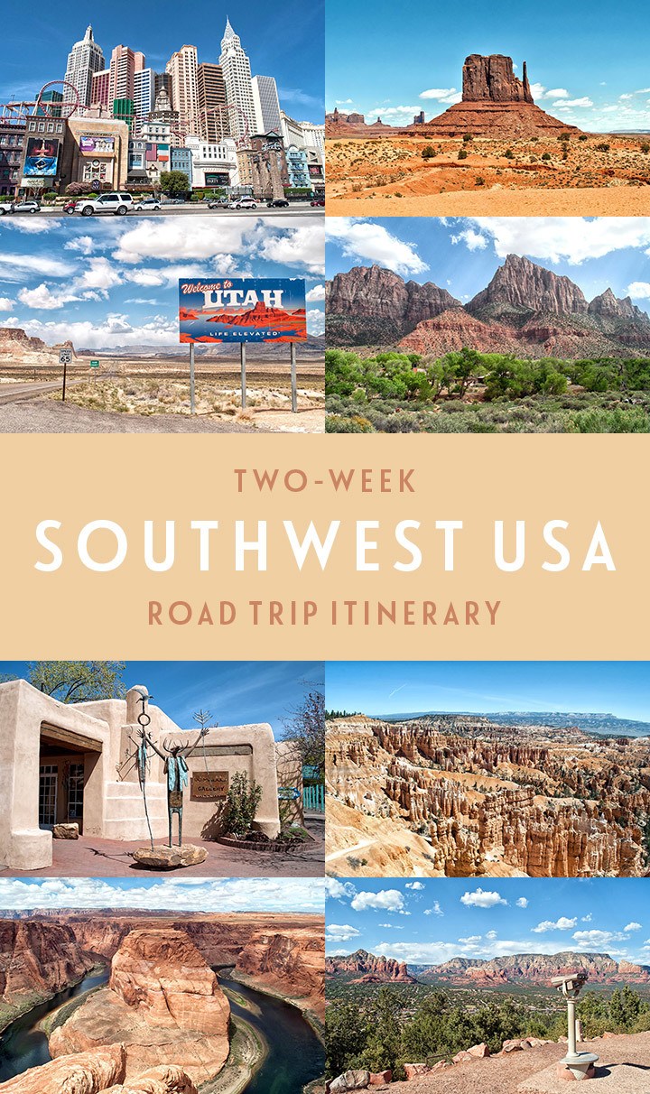
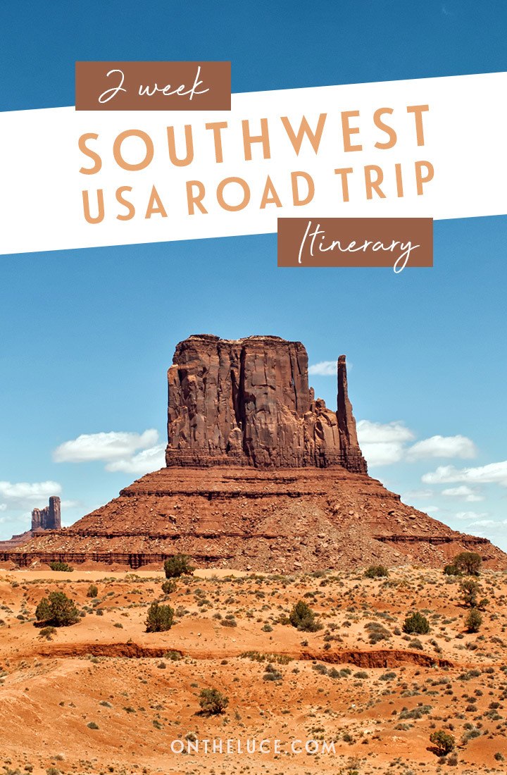
A two-week southwest USA road trip itinerary
Discover the perfect 14-day/two-week southwest USA road trip itinerary – featuring National Parks, scenic drives, stunning views, famous film locations and quirky roadside attractions.
* This site contains affiliate links, where I get a small commission from purchases at no extra cost to you.
The USA is the spiritual home of the road trip. Think long straight roads disappearing over the horizon, roadside diners and quirky motels. And probably the most iconic US road trip destination is the southwest USA. Monument Valley, the Grand Canyon, Arches National Park, Route 66 – even if you’ve never visited the southwest before you’ll still feel like you already know it from films and TV shows, from Thelma and Louise to Tombstone.
So if you want to hit the road, here’s my perfect itinerary for a two-week southwest USA road trip, taking in the highlights across five states, six national parks and something like 2000 miles – with details of what to see and where to stay along the way.
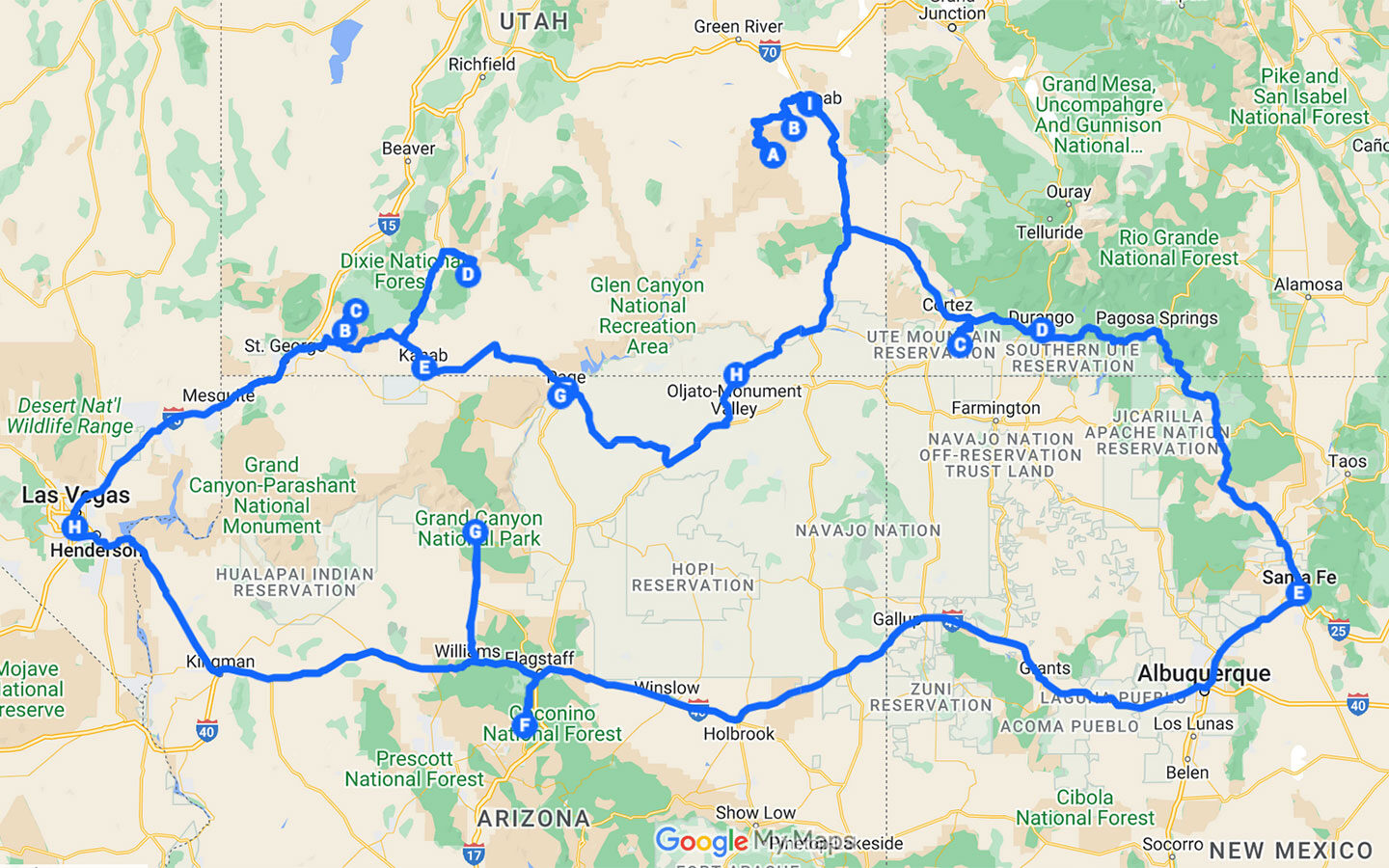
Southwest USA road trip map
A note on driving times and distances
Driving times listed are based on Google Maps estimates and don’t include stops along the way. The road conditions in the southwest vary hugely so the same mileage can take totally different amounts of time. Daily driving distance/time figures cover getting from place to place and don’t include the drives within National Parks en route.
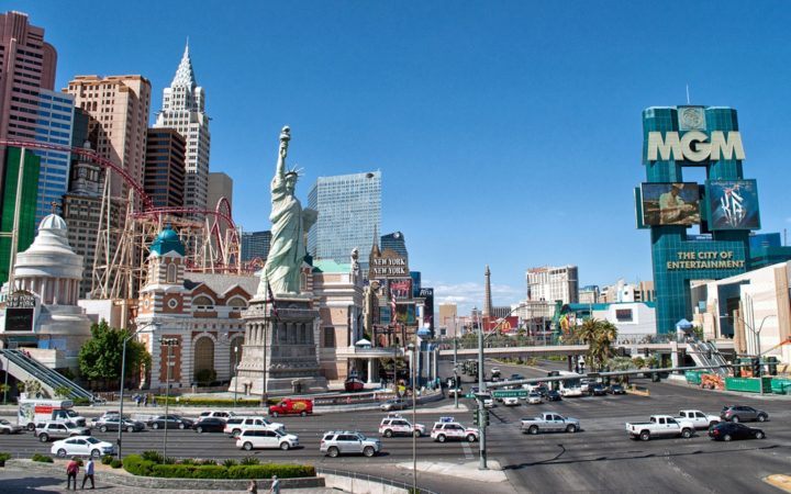
Day 1: Arrive in Las Vegas
Arrive into McCarran International Airport, which is only 15 minutes’ drive north of the city, and take a taxi or shuttle to your hotel. There are a huge amount of things to see in Las Vegas and you only have a brief stop here, so choose a few of the highlights.
Don’t miss the Bellagio fountains which are illuminated at night, and catch a show on the Strip – there are usually a few different Cirque du Soleil shows as well as a mix of magic acts, music tributes and big-name artists. You will need to book ahead for really popular shows but you can bag other last-minute tickets from Tix4Tonight outlets.

Where to stay in Las Vegas: There are so many hotel options in Vegas, but as you only have one night, I’d recommend staying in the central Strip. That way you’re right at the heart of the action and don’t have to waste time in the city’s crazy traffic. Paris Las Vegas, Vdara, Caesar’s Palace, the Venetian and Flamingo are all really central – prices vary hugely though so it’s worth shopping around and being flexible about where you stay.

Day 2: Las Vegas to Zion
Spend the morning exploring Las Vegas. You can travel the world along the Strip – watch gondoliers at the Venetian, climb the Eiffel Tower at Paris Las Vegas, walk across the Brooklyn Bridge at New York New York, see the pyramids at the Luxor, visit the Bellagio’s botanical gardens and scream your head off on the rides on top of the Stratosphere.
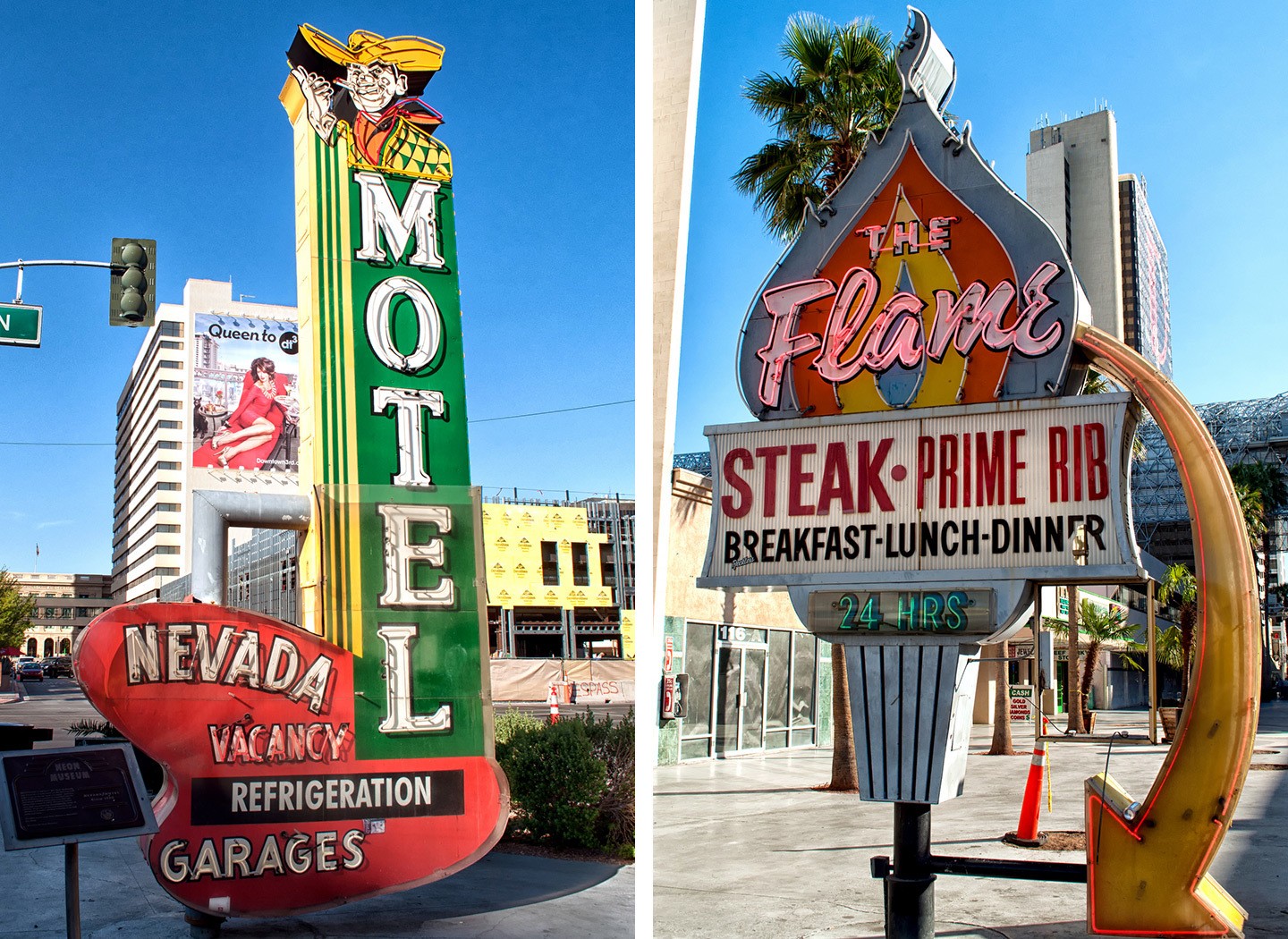
Or you can head up to Fremont Street for a taste of Old Vegas. This historic district has retro casinos and a zipline running right down the street. You can also see vintage signs at the Neon Museum and find out about the city’s Mafia story at the Mob Museum.
After lunch, pick up a hire car (it’s worth comparing prices between picking up a car on the Strip or at the airport to find the cheapest deal) and start your southwest USA road trip. It’s a good idea to stock up on a few supplies before you leave – like water, drinks and snacks. There’s both a Walmart and a Whole Foods really close to the airport.
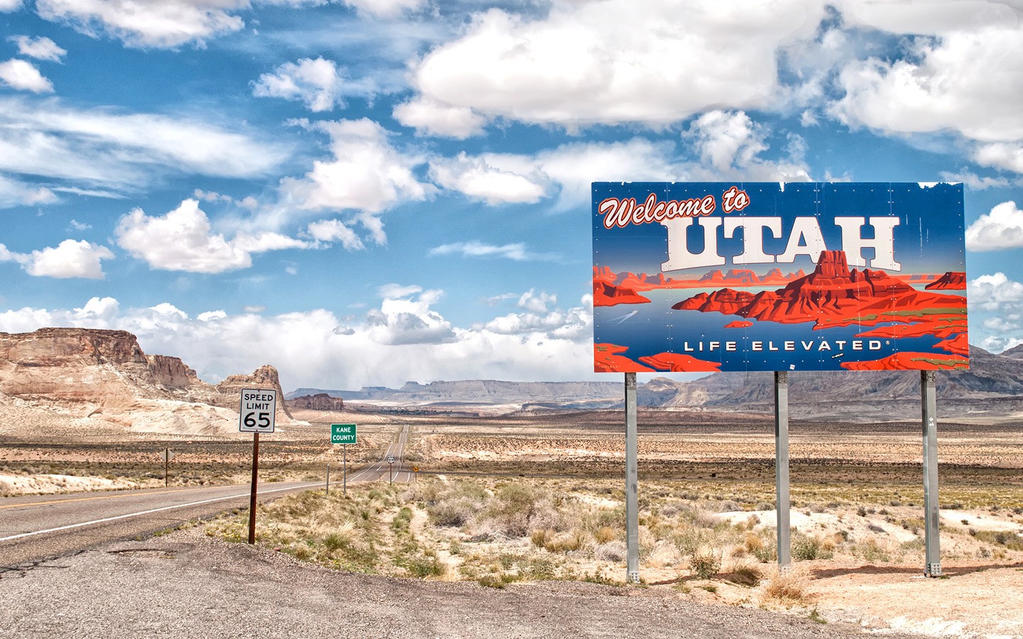
Then leave the city behind and take Highway 15 north for 153 miles/2.5 hours towards Zion National Park. Don’t forget when you’re planning your timings that Utah is in a different time zone to Nevada, so you will lose an hour along the way.
Total driving: 153 miles/246 kilometres – approx 2.5 hours
Where to stay in Zion: The nearest hotels to Zion are in Springdale, but for something a bit different you can camp out in style on the edge of the National Park at Under Canvas Zion*. These luxury glamping tents come with proper beds, a mix of private and shared bathrooms, and some have wood-burning stoves. The view of Zion’s red rocks are the main attraction, but there’s also a restaurant with a fire pit to toast marshmallows on.
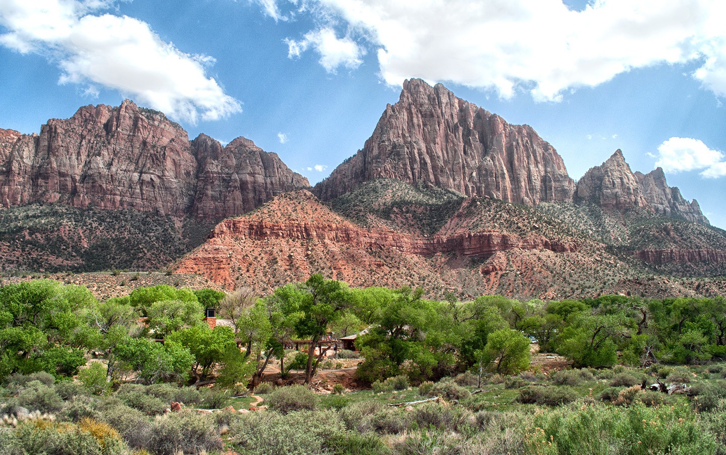
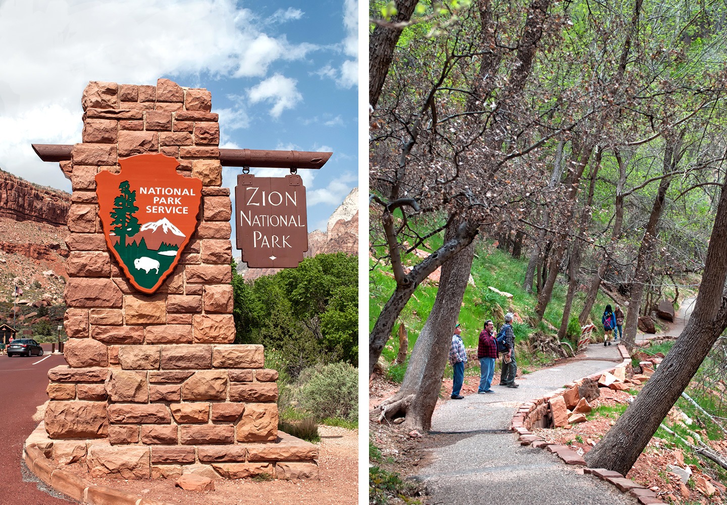
Day 3: Zion National Park
From the camp it’s 20 miles/35 mins to the entrance of Zion National Park. Private vehicles aren’t allowed in the park from March to October, so you’ll need to leave your car at the visitor’s centre and catch the shuttle bus. If you’re reasonably fit and the weather is good, you can tackle one of Zion’s big hikes – Angels’ Landing or The Narrows.
The adventurous Angels’ Landing hike (5.4 miles/4 hours) takes you up vertigo-inducing chained paths bolted into the cliffs for spectacular views from the top. Or the Bottom Up section of the Narrows (4–10 miles) takes you along a narrow river slot canyon – you need to wade along the river bed though so it’s best done on a warm day.
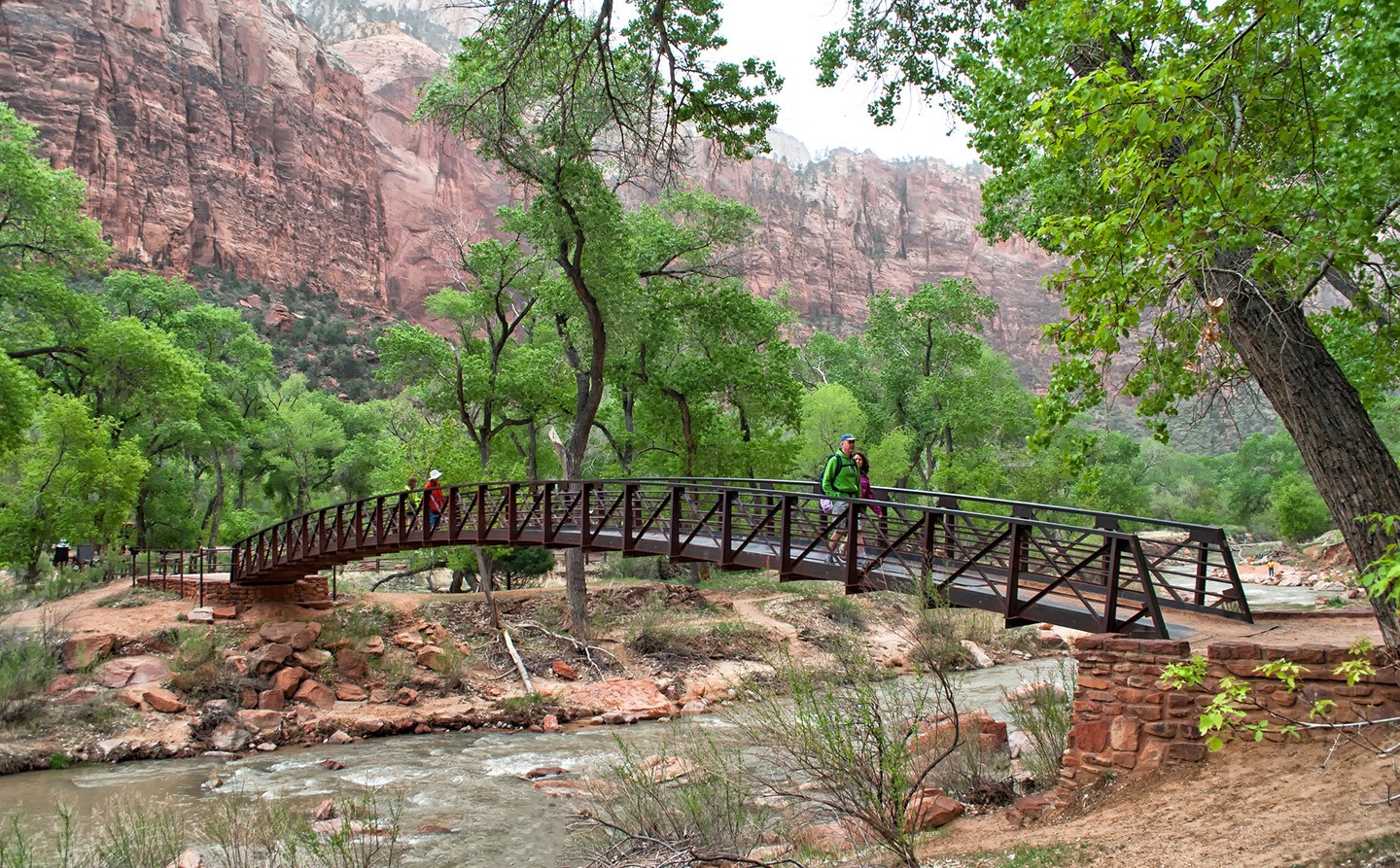
For something gentler, catch the shuttle to the Emerald Pools Trail for an hour-long walk to the lower pool and another hour to the upper pool. Head back to Zion Lodge, where there’s a café and picnic area if you want to stop for lunch before catching the next shuttle.
Stop off at Weeping Rock for a short walk to the cascades, then get the shuttle to the end of the road for the two-mile-long Riverside Walk. Leave the park and make the 77-mile/1.5 hour drive to Tropic via Route 9 – the Zion–Mount Carmel scenic drive. It runs through the original 1920s tunnel and past the strange rock formations at Checkerboard Mesa.
Total driving: 97 miles/156 kilometres – approx 2 hours 5 mins
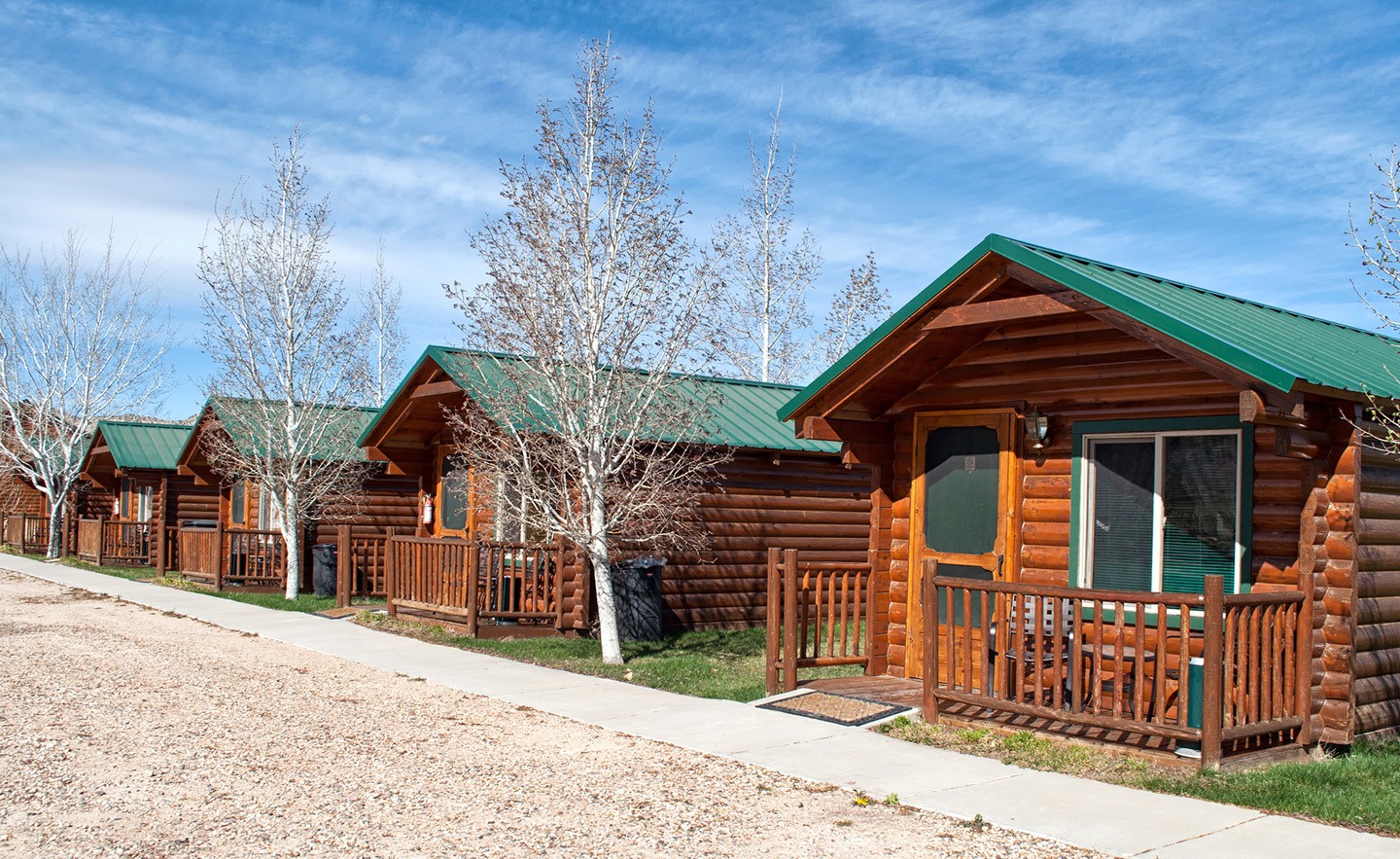
Where to stay in Tropic: Just off Scenic Byway 12, Bryce Country Cabins* in Tropic are one of the closest places to stay for Bryce Canyon. Ours was small but perfect formed, with two queen-sized beds, an en-suite bathroom and small kitchenette. With all that pine they look a bit Alpine, with heaters and blankets to keep you warm on a cold night.
If it’s sunny there are tables and chairs out the back and barbecues you can borrow if you want to cook for yourself – or The Pizza Place a few minutes away does takeaway pizzas.
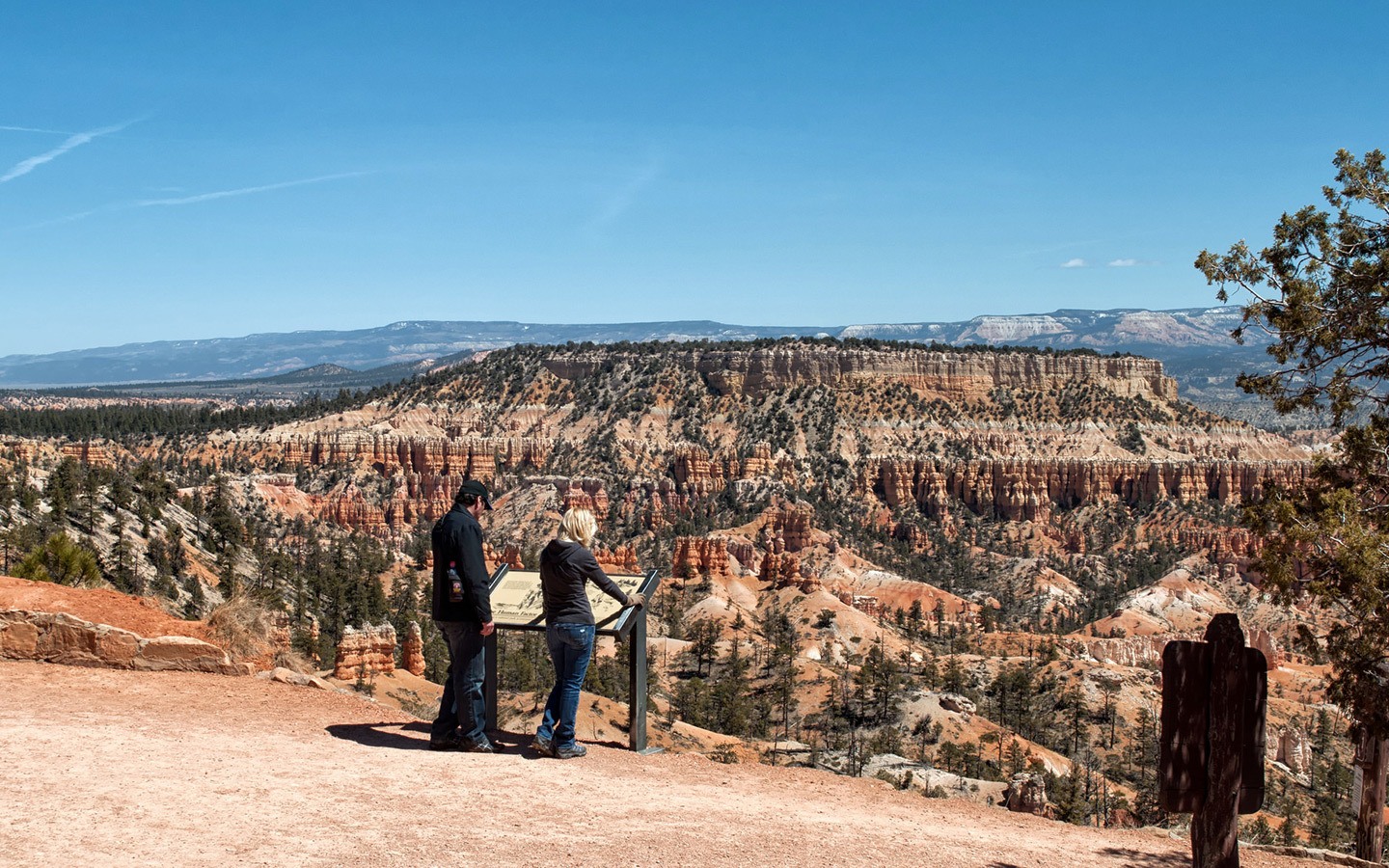
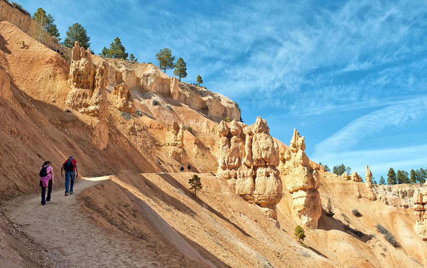
Day 4: Bryce Canyon National Park
Tropic is only 10 miles from the entrance to Bryce Canyon National Park, so you can get there early and spend a full day exploring . Follow the 18-mile-long scenic drive around the park, starting in the Bryce Amphitheater area. Park up at Sunset Point and follow the Rim Trail for a mile along to Sunrise Point, a good place to get down into the canyon.
Get up close to the hoodoos on one of the hiking trails. The Queen’s Garden Trail from Sunrise Point is the easiest at just under two miles, or there’s the steeper 1.5-mile Navajo Loop Trail from Sunset Point. You can also combine the two into a longer route.
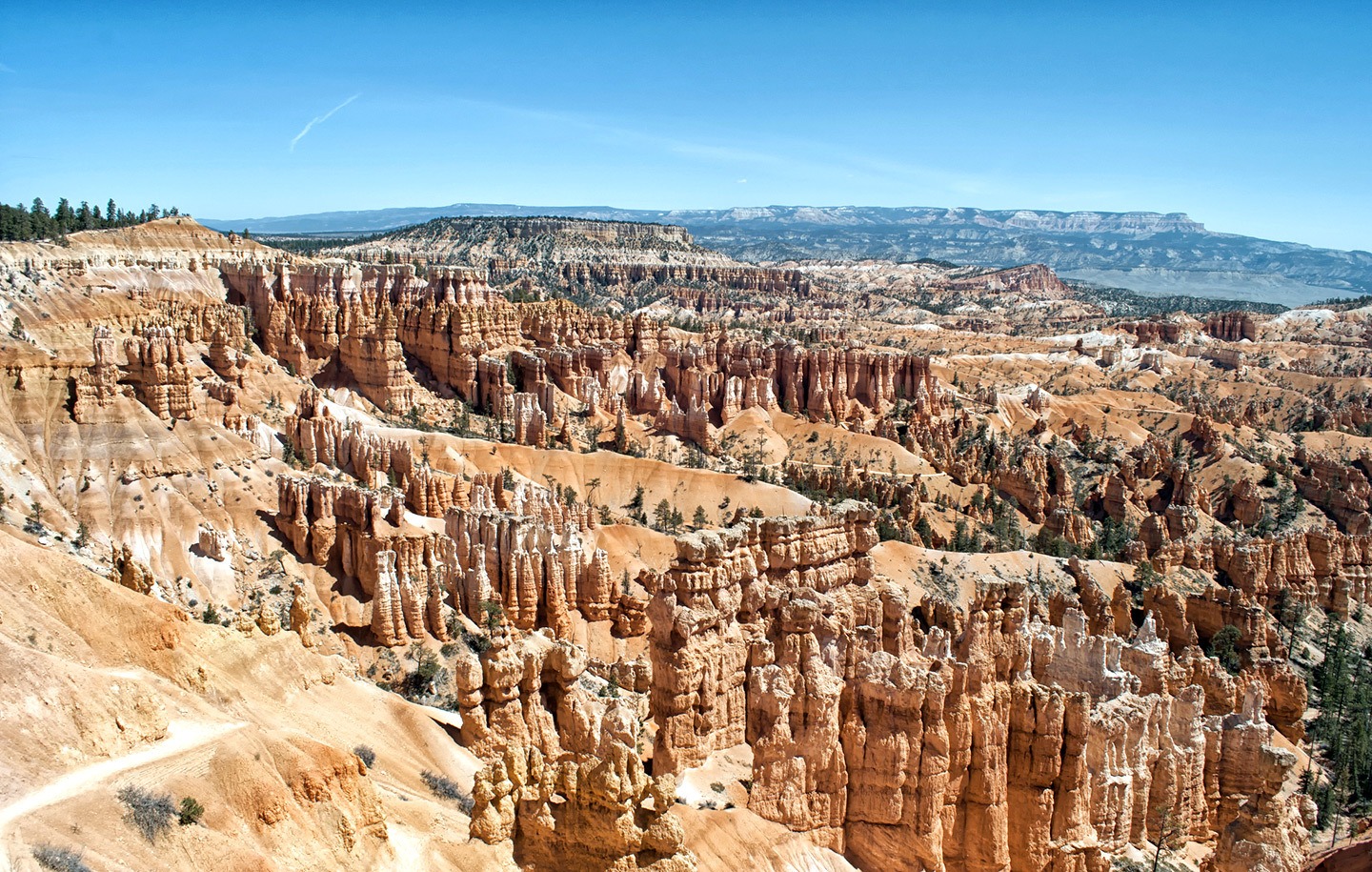
After your hike, drive on around the edge of the amphitheatre to the viewpoints at Inspiration Point, Bryce Point and Paria View. Then leave the Bryce Amphitheater area and head out along the road to the furthest point at the Rainbow Point viewpoint.
There are plenty of places to stop for a picnic with a great view along the way – my favourites were the arch at Natural Bridge, the two towering hoodoos at Agua Canyon and the wide views from Rainbow Point. Then leave Bryce Canyon National Park and head south down Highway 89 towards the town of Kanab (77 miles/1.5 hours).
Total driving: 87 miles/140 kilometres – approx 1 hour 40 mins
Where to stay in Kanab: You can’t really do a US road trip without spending at least one night in a proper motel. Quail Park Lodge* in Kanab looks straight out of the 1950s from outside, but inside its 13 rooms have been refurbished and updated.
The motel comes with lots of nice extras – like vintage bikes you can borrow, a pool in summer, a glass of wine on arrival, morning pastries and fruit, and free international phone calls. It’s an easy walk into town for dinner – we liked Rocking V Cafe, an art-filled space that specialises in slow food with a good range of vegan and gluten-free options.

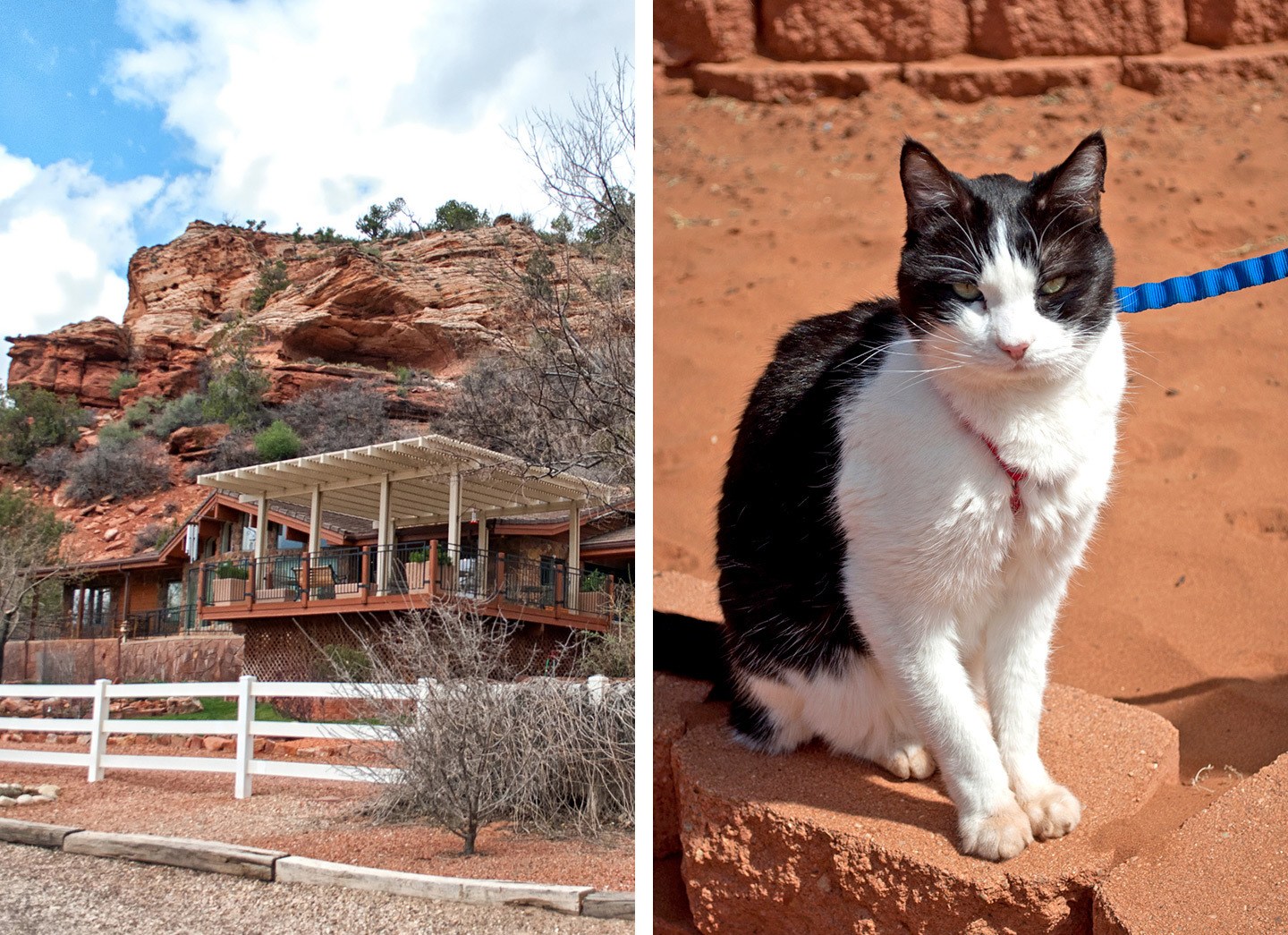
Day 5: Best Friends Animal Society
The southwest USA is all about the natural beauty, but for something a bit different, you can spend the morning volunteering with animals at Best Friends Animal Society. Their base at Angel Canyon is just 10 minutes outside of Kanab, and is the biggest no-kill animal sanctuary in the US with over 1600 cats, dogs, pigs, rabbits, horses and parrots on site.
You can choose which animals to spend time with. We spent our morning feeding and stroking cats but you can also socialise dogs, groom horses or even walk a potbellied pig.
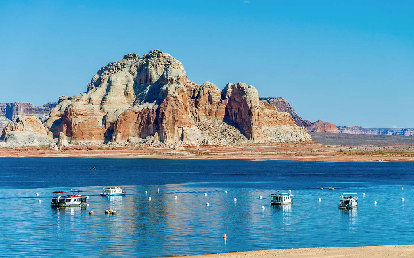
After lunch at the centre, follow Highway 89 to the east on the 80 mile/1 hour 20 min drive to Page, across the border in Arizona. Just before you get there you’ll reach Lake Powell and the spectacular Glen Canyon Dam, where there’s a visitors centre and viewpoint.
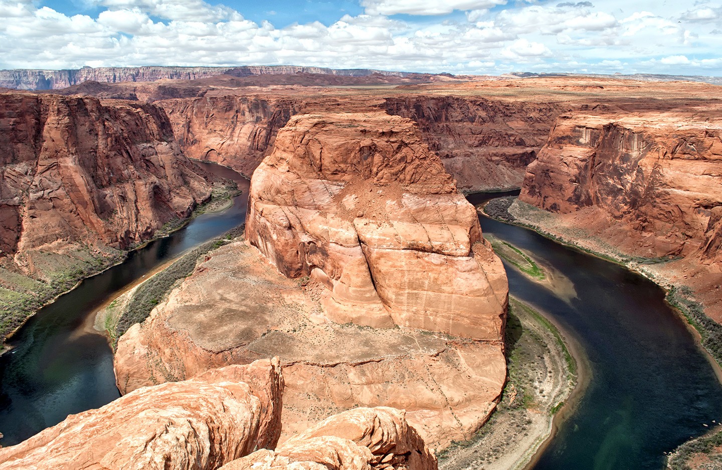
You can then either take a sunset cruise around Lake Powell or head to Horseshoe Bend – a perfect meandering arc of the Colorado River that cut its way down through the sandstone over million of years. It’s 5 miles south of Page on Highway 89, between mileposts 544 and 545, with a short sandy walk to the canyon rim and a dramatic 1000-foot drop to the river.
Total driving: 97 miles/156 kilometres – approx 1 hour 50 mins
Where to stay in Page: The Best Western View of Lake Powell Hotel* unsurprisingly has a great view of Lake Powell, and a pool and hot tub to relax in in summer. It’s fairly standard chain hotel in style but has a good location with spacious rooms and breakfast is included. Page gets busy so it’s a good idea to book well in advance. There are a few places to eat nearby – El Tapatio is recommended for its giant portions of Mexican food.
Day 6: Antelope Canyon & Monument Valley
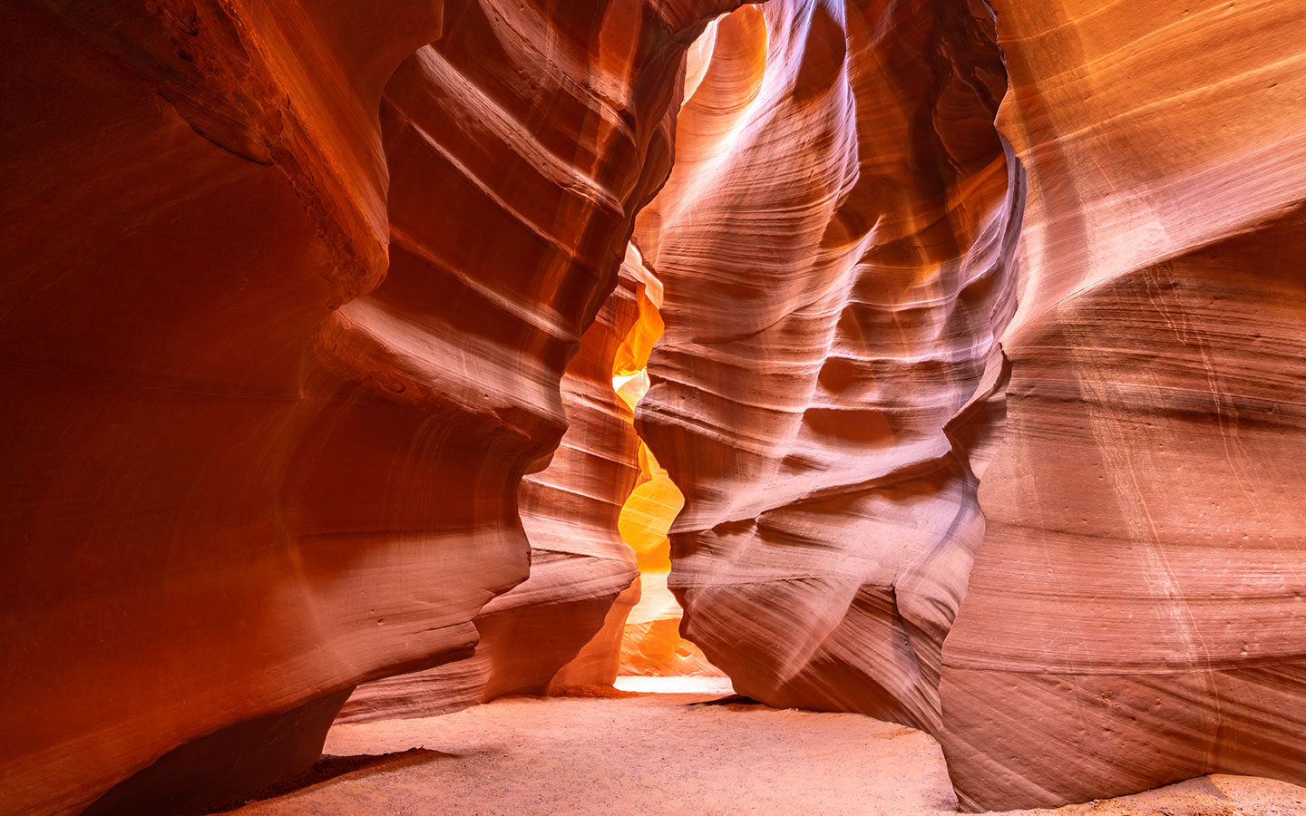
Head 8 miles/15 mins out of Page to one of the southwest’s most recognisable spots – Antelope Canyon. This slot canyon is famous for its curving red rock walls with those super-photogenic beams of light filtering through. The only way you can visit the canyon is on a tour*, and they’re hugely popular so book as soon as you can.
There are two sections – the Upper and Lower Canyon. The Upper Canyon is where you’ll see the light beams, which are best in the mornings. But beware the canyon can get crowded, and the flood risk means that tours are often cancelled if it rains.
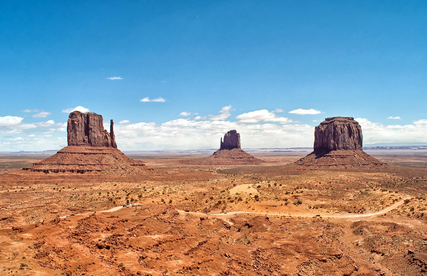
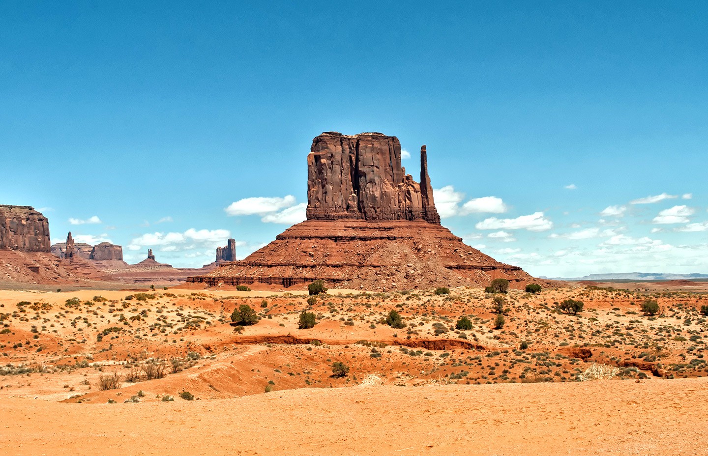
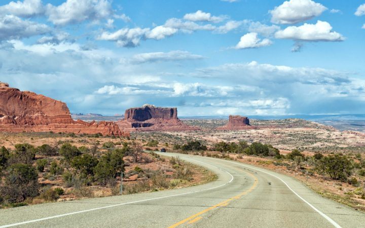
Carry on along Highway 98 then take the 160 north-east on the 116 mile/2 hour drive to another southwest icon – Monument Valley. North of Kayenta, huge rock buttes emerge out of miles of empty desert scrubland, coloured in vivid shades of gold, orange and pink.
They’re named after their shapes, so you can try and spot the Mittens, the Thumb and the Totem Pole. Inside the Monument Valley Navajo Tribal Park there’s a visitors centre and a 17-mile scenic drive which takes you through the rock formations. It’s unpaved and pretty rough, so it’s best done in a 4×4 and takes at least two hours with photo stops.
Total driving: 124 miles/200 kilometres – approx 2 hours 15 mins
Where to stay in Monument Valley: There’s not much around Monument Valley, but both The View and Goulding’s Lodge* have fantastic views of the rocks, and it’s well worth staying the night just to watch the amazing sunrises and sunsets. Both have a mix of hotel rooms and cabins, with balconies looking out over the valley, as well as camping spots and Navajo restaurants (but note that alcohol is prohibited on Navajo land).
Day 7: Arches National Park
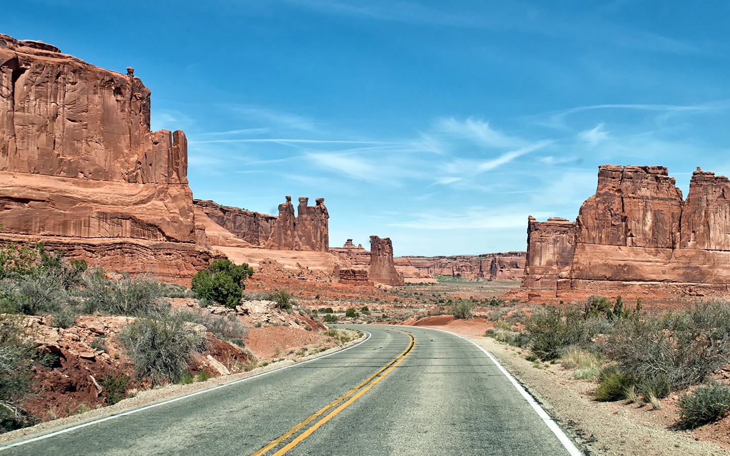
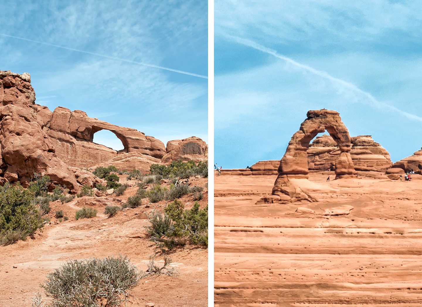
Leave Monument Valley behind in the morning and head back into Utah, following Highway 191 to Arches National Park (151 miles/2 hours 40 mins). The park has the world’s largest concentration of rock arches, with over 2000 of all shapes and sizes.
Start your Arches exploration at Park Avenue Viewpoint, then drive to Balanced Rock, where a short circular path runs around a precariously perched rock. Then turn off towards the Windows Section of the park for the short walks to Double Arch (half a mile) and around the loop passing the North and South Windows and Turret Arch (one mile).

Drive back to the main road then take the turn off to the right towards Delicate Arch – famously pictured on Utah’s license plates. The route out to the arch is one of the best hikes in Arches National Park and covers three miles, with some steep sections along the way. It’s best done in late afternoon during the summer as there’s not a lot of shade.
Or if you’re short on time you can follow the lower one-mile path to Delicate Arch Viewpoint instead, where you get a great view of the arch across the canyon. Then drive 5 miles/20 mins to the town of Moab, where you’ll be spending the next two nights.
Total driving: 156 miles/251 kilometres – approx 3 hours
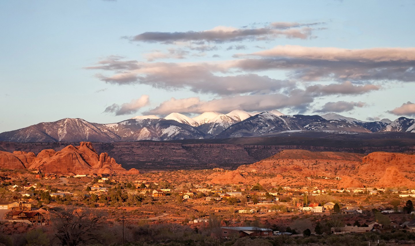
Where to stay in Moab: Moab’s a popular spot so book accommodation well in advance at weekends. The eco-friendly Moab Springs Ranch* is surrounded by trees and streams. They have two types of accommodation – studio bungalows and two/three-bedroom townhouses. And there’s a pool, hot tub and campfire. Moab’s quite sprawling though so you may have to drive to get to places to eat – the Moab Brewery is worth a visit.
Day 8: Canyonlands National Park
Take the 30 mile/35 minute drive to Moab’s other local (and less well-known) National Park – Canyonlands. The park is is divided into three sections, but if you want good views then concentrate on the Islands in the Sky district, which is the most accessible area. Stop off at the visitors centre first where there’s a short walk out to the Shafer Canyon Overlook.
Then drive on to Mesa Arch where there’s a half-mile walk out to an arch on the edge of a cliff. The road then splits – take the right fork to Upheaval Dome, where there’s one viewpoint after a mile’s walk out onto the dome and a second viewpoint a mile further on.
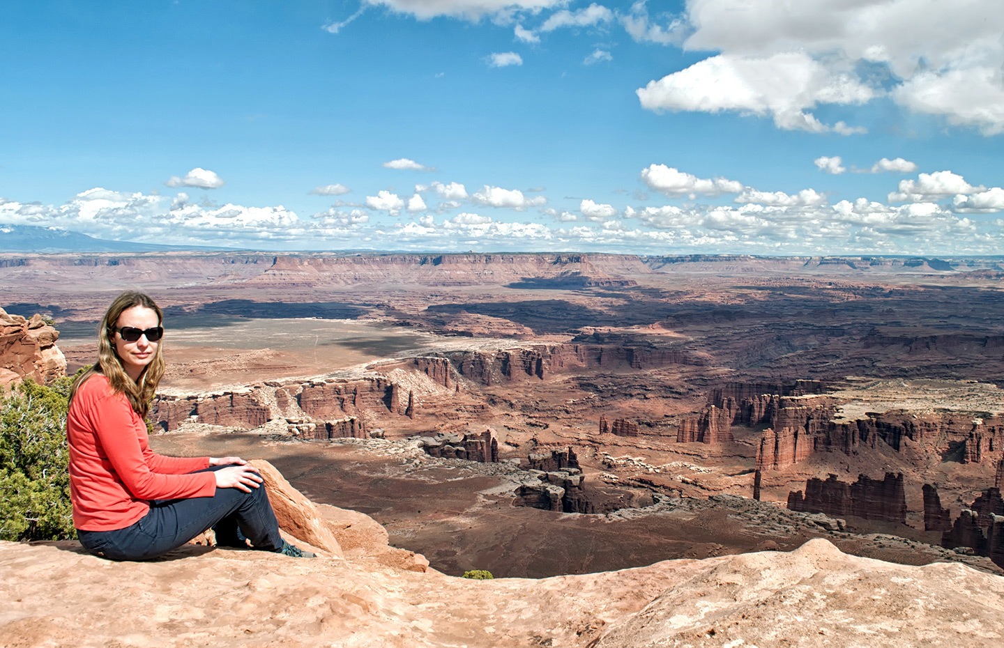
Then backtrack to the junction and take the left fork and follow the road out to the end at Grand View Point, stopping off at the Green River and Buck Canyon overlooks on your way for some of the park’s most spectacular views. On your way back to Moab, stop off at Dead Horse State Park, where one of the classic US road trip movies was filmed.
When Thelma and Louise drive off the edge of the Grand Canyon at the end of the film, it’s really Dead Horse Point State Park (supposedly named for a gory tale of horses being left to die of thirst on a corral above the river). Then head back to Moab for a second night.
Total driving: 70 miles/113 kilometres – approx 1.5 hours

Day 9: Mesa Verde National Park
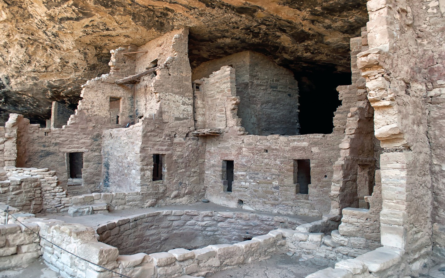
Leave Moab behind and head south on Highway 191 – though it’s worth making a quick stop at the quirky Hole n’ the Rock along the way. About 20 mins out of town, this bizarre house has been carved out of a sold rock face. Then cross over into Colorado on the 491 and follow the road towards Mesa Verde National Park (145 miles/2 hours 50 mins).
This area was home to the Ancestral Puebloans 1000 years ago who built houses in the side of the cliffs. You can only visit most of the cliff houses on ranger-led tours. So stop off at the visitors’ centre to book an hour-long tour of either Cliff Palace, the largest cliff house, or Balcony House where you climb through tunnels and up ladders.
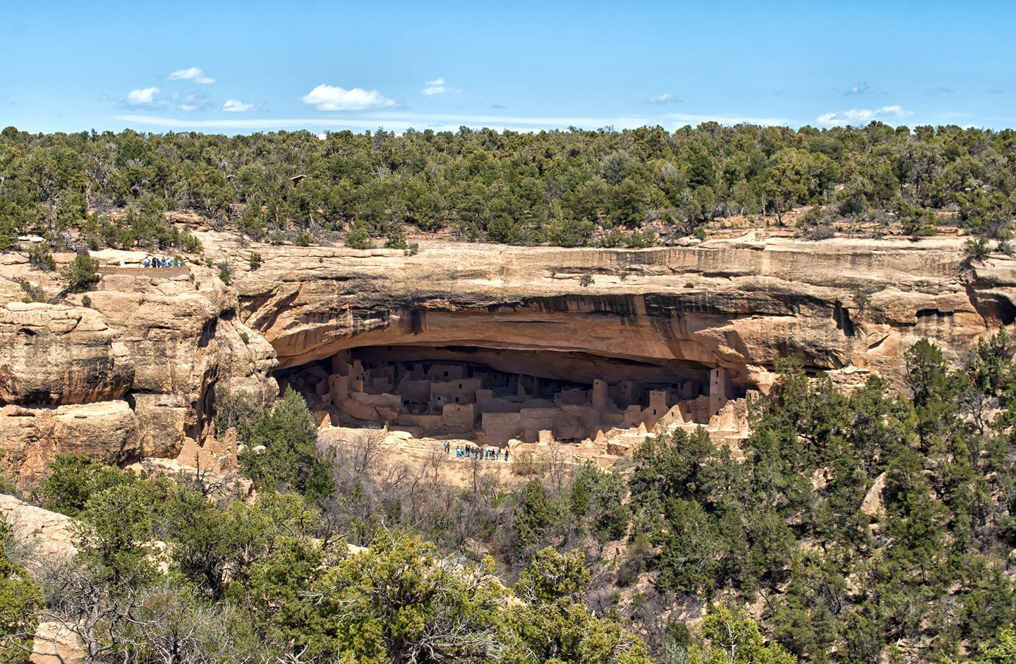
Then drive the winding road up to Mesa Verde’s plateau, stopping off at the overlooks on the way to take in the views. The park’s biggest concentration of sights is in the Chaplin Mesa area. Call in to the Chaplin Mesa Museum to learn about the Puebloans.
There’s also a lookout over Spruce Tree House, the best-preserved cliff house (closed to visitors after a rockfall). Then drive the six-mile Mesa Top Loop where there are stops at short walkways to pit houses, the Sun temple and great views of the cliff houses across the valley. Finally drive back to Highway 60 and 56 miles/1 hour 15 mins to Durango.
Total driving: 200 miles/322 kilometres – approx 4 hours
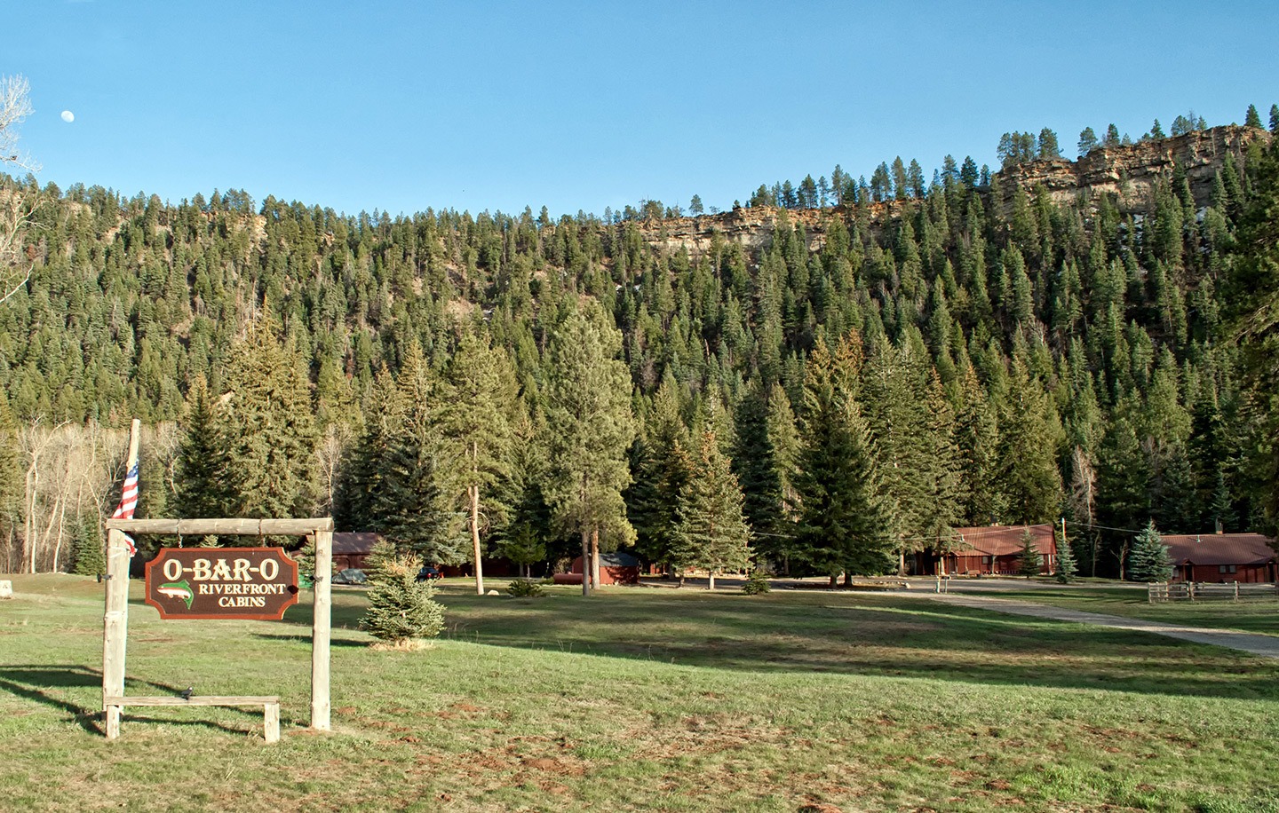
Where to stay in Durango: O-Bar-O Cabins was my favourite stay on this southwest USA road trip. These log cabins are 20 minutes outside of Durango in a lovely peaceful pine forest. There are nine different cabins, our Birdnest was the smallest but was beautifully designed, with a full kitchen, terrace and grill – plus a shared riverside hot tub. It’s a way from anywhere so stock up on food for the night, or head into Durango.
Day 10: Santa Fe
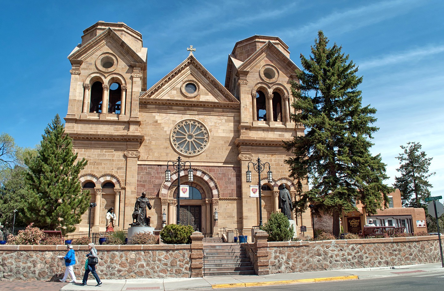
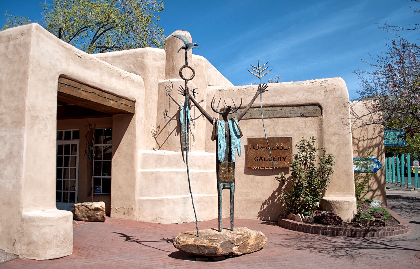
Head east out of Durango to Highway 160 and then travel south on the 84 along the edge of the Carson National Forest on your way to Santa Fe (212 miles/3 hours 45 mins). Then spend the afternoon exploring Santa Fe – it’s one of the oldest cities in the US which has a unique mix of Native American and Hispanic cultures.
Take a history and food walking tour* around the old town’s characteristic adobe buildings. Soak up the sunshine in the Plaza, shop for silver and turquoise Native American jewellery outside the Palace of the Governors, check out the miraculous staircase in the Gothic-style Loretto Chapel and call in at the Cathedral Basilica of Saint Francis.
Santa Fe is a real hub for artists, and there are hundreds of studios and galleries running along the half-mile-long Canyon Road, as well as museums dedicated to folk art, Indian art and the painter Georgia O’Keefe. There’s also the trippy Meow Wolf, a immersive art experience that’s a bit like walking into a video game.
Take a walk to the city’s regenerated railroad district, where old warehouses have been converted into galleries and restaurants. And don’t miss the city’s Mexican food and margaritas – Santa Fe is justifiably famous for both.
Total driving: 212 miles/341 kilometres – approx 3 hours 45 mins
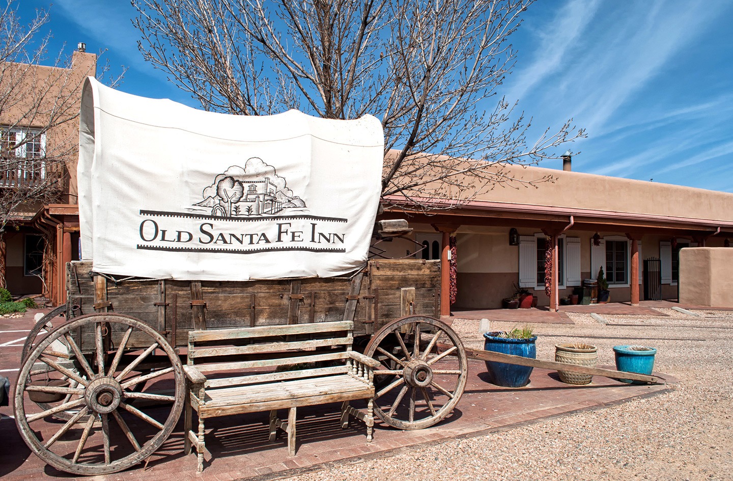
Where to stay in Santa Fe: The Old Santa Fe Inn* is classic New Mexico style with lots of dark wood, local art and big bunches of dried chilies hanging outside. We stayed in a traditional kiva room with a king-sized bed, sitting area, fireplace and jacuzzi bath.
There’s a free breakfast buffet every morning, Starbucks tea and coffee in the lobby all day, and free cookies or chips each afternoon. The hotel is a short walk from the plaza, where we headed up onto the terrace at the Rooftop Pizzeria for blue corn pizzas and local beers.
Day 11: Route 66
You can’t really have a US road trip without driving a stretch of The Mother Road – Route 66. The route’s longest driving day covers 412 miles on your way to Sedona in Arizona, where you spend the next two nights. First leave Santa Fe and head to Albuquerque where you join the I-40, the interstate which follows some of old Route 66.
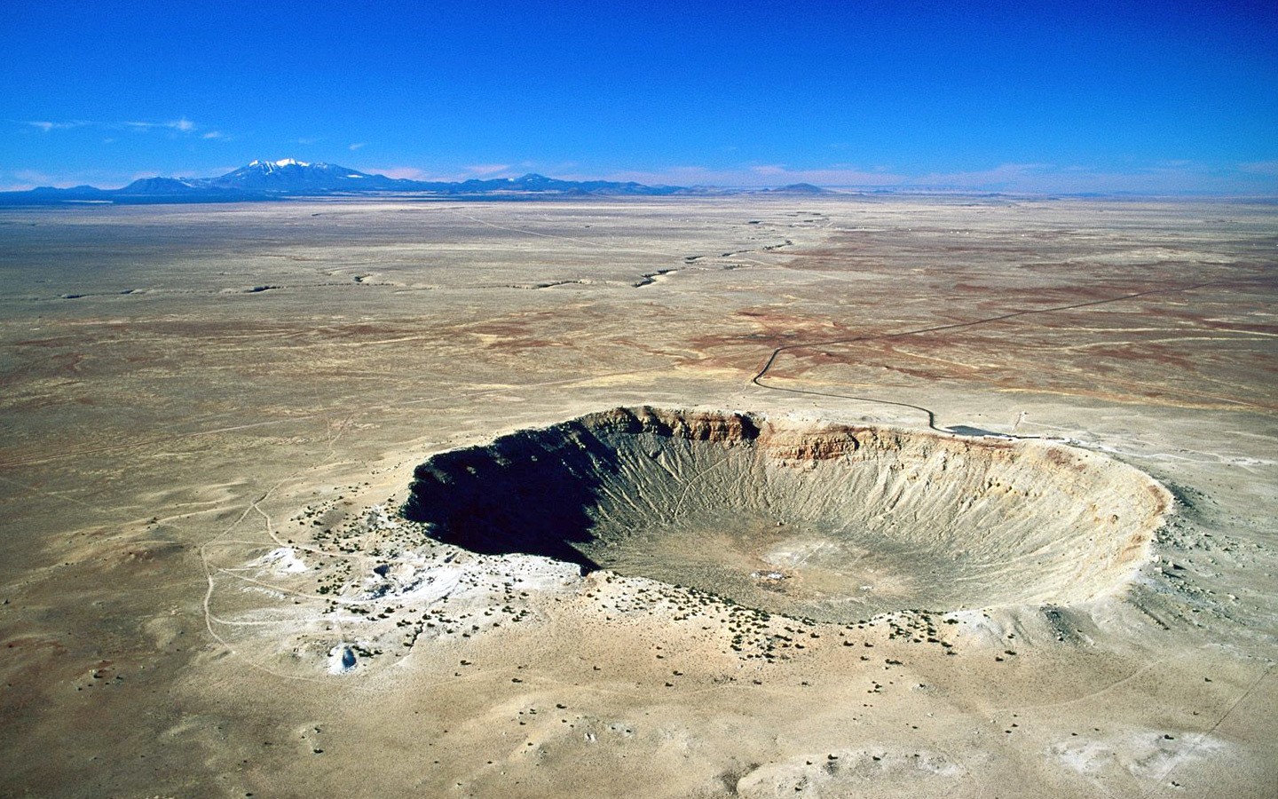
There are a few good places to stop off along the way. Petrified Forest National Park is made up of fossilised trees dating back to the time of the dinosaurs. Or the Meteor Crater is the world’s best preserved meteor impact site, stretching nearly a mile across.
You can still see some of the vintage-style diners, motels and petrol stations which lined the old Route 66, like in Winslow Arizona (one for the Eagles fans). At Flagstaff, leave Route 66 and head south to Sedona on Highway 89A – the Red Rock Scenic Byway. It runs through Coconino National Forest then zig-zags down into Oak Creek Canyon with beautiful views.
Total driving: 412 miles/663 kilometres – approx 6 hours 15 mins
Where to stay in Sedona: The Sky Ranch Lodge* is a bit out of town on Airport Mesa but has spectacular panoramic views – it’s worth staying there just for the sunsets. Rooms are motel style with most having balconies and there’s a pool and jacuzzi in the gardens. There’s no restaurant at the hotel but the Mesa Grill is only a few minutes’ walk away (located inside Sedona tiny airport) and does tasty southwest dishes.
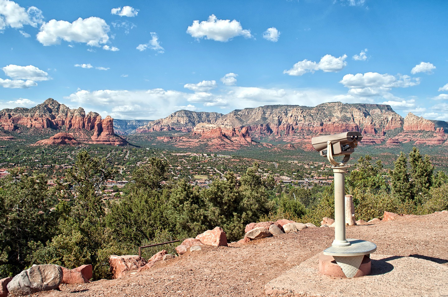
Day 12: Sedona
Spend the day exploring Sedona, a southwest town with a spiritual side. It’s said there are vortexes in the red rocks around town – sacred spots where energy flows radiate the Earth’s power. Whether you believe it or not, the rocks are spectacular to look at.
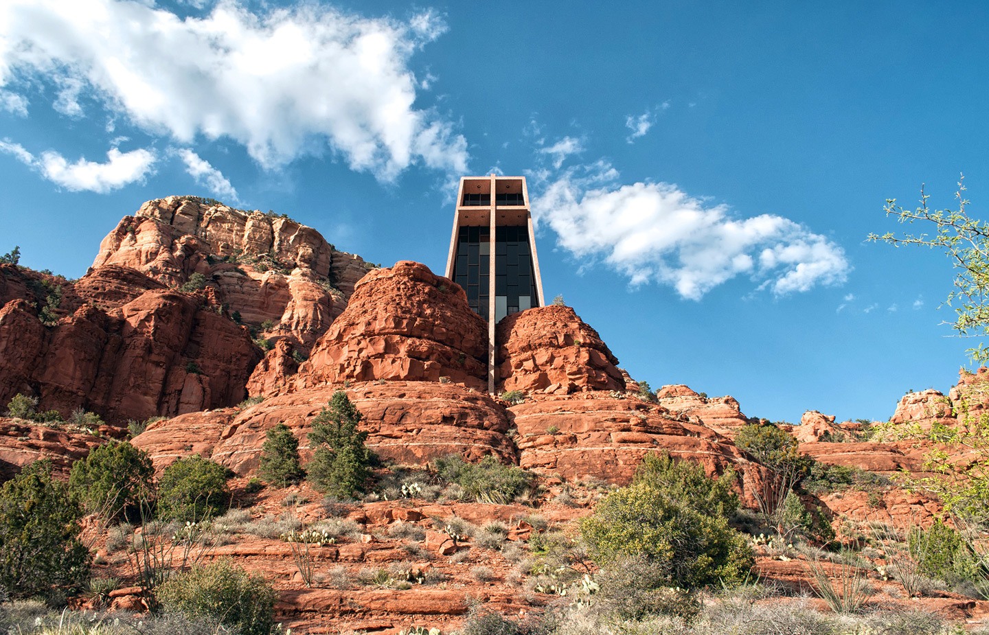
Take the seven-mile Red Rock Loop scenic drive to see the most famous vortexes: Cathedral Rock, Courthouse Butte and Bell Rock. Don’t miss the unique Chapel of the Holy Cross too – a 1950s Catholic chapel that looks like a Bond villain’s lair. Or head out on a Sedona hike and visit Slide Rock State Park for swimming and sliding down an 80-metre rock chute.
There are also a few good half-day trips from Sedona, depending on what you’re interested in. There’s the ghost town of Jerome which is 28 miles away. This old copper and gold mining town was known as the ‘Wickedest Town in the West’ in the 1890s. The saloons and brothels have closed but you can still see a lot of the historic buildings.
Or the Verde Valley Wine Trail has nine different vineyards to visit. And if you don’t have time to get out to the wineries, you can also try local wines at Sedona’s Art of Wine.
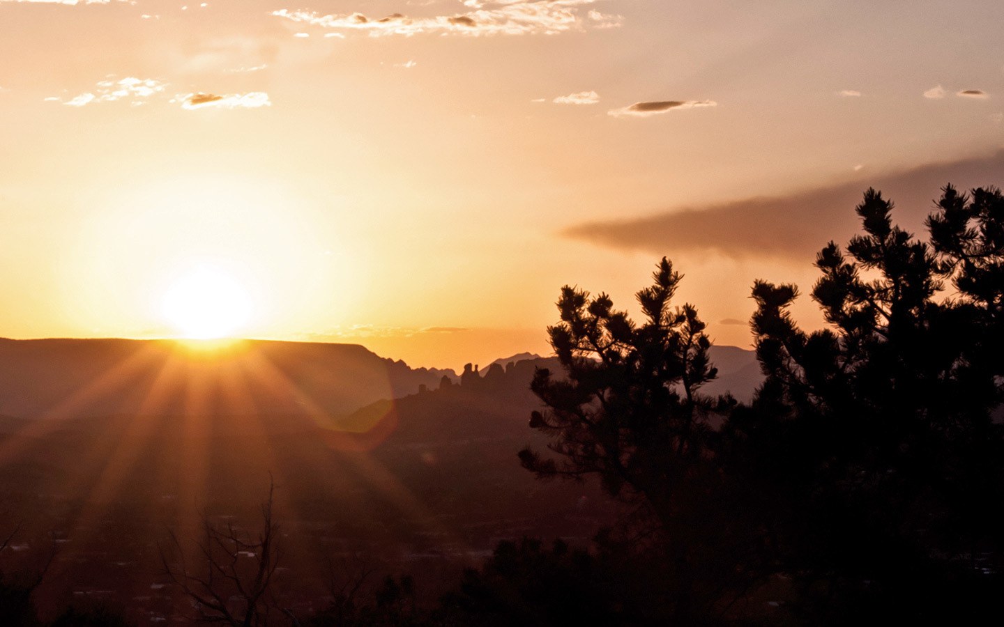
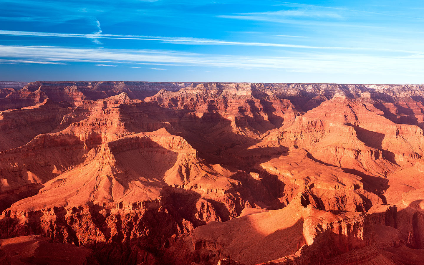
Day 13: Grand Canyon
Leave Sedona and head back to Flagstaff and then travel north to the Grand Canyon’s South Rim (114 miles/2 hours 15 mins). Drive out to Desert View for that first breathtaking look down into the canyon and the watchtower observation deck. Then head on to the visitor centre where you can leave your car behind and catch the free shuttle.
There are a few different shuttle routes – the blue route takes you from the visitor centre to the village, and from there you can catch the red route, which is a loop stopping off at some of the most scenic lookout points along Hermit’s Rest Road.
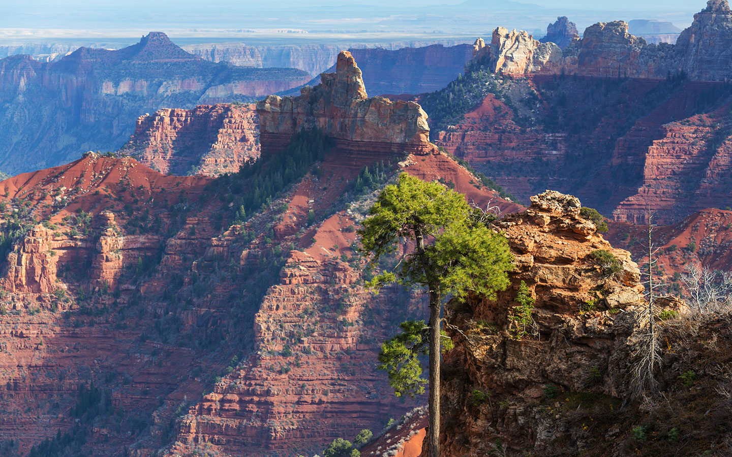
There are walking trails along the rim, but it’s also worth heading down into the canyon to get a closer view of it from a different angle. There’s not enough time to make it all the way to the bottom in half a day, but you can do a shorter walk like the three-mile hike along the South Kaibab Trail to Cedar Point or the hike along the Bright Angel Trail as far as 1.5 Mile Resthouse. Then head to one of the viewpoints for that perfect Grand Canyon sunset.
Total driving: 114 miles/183 kilometres – approx 2 hours 15 mins
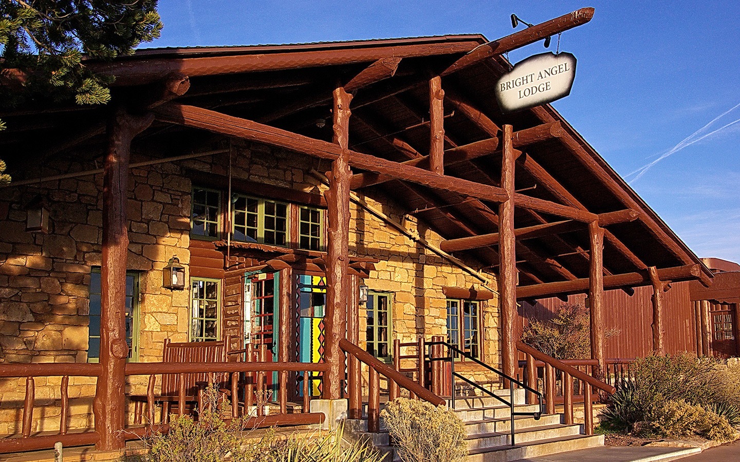
Where to stay at the Grand Canyon: Flagstaff is the closest place to the Grand Canyon which has a decent selection of hotels, but it’s still 90 minutes away. So we spent the night at the Bright Angel Lodge, which is right inside the park. It’s a 1930s timber lodge with a mix of hotel rooms and cabins – the cheapest options have a shared bathroom. There’s a café and a steakhouse-style restaurant on site and those amazing views just outside.
Day 14: Depart Las Vegas
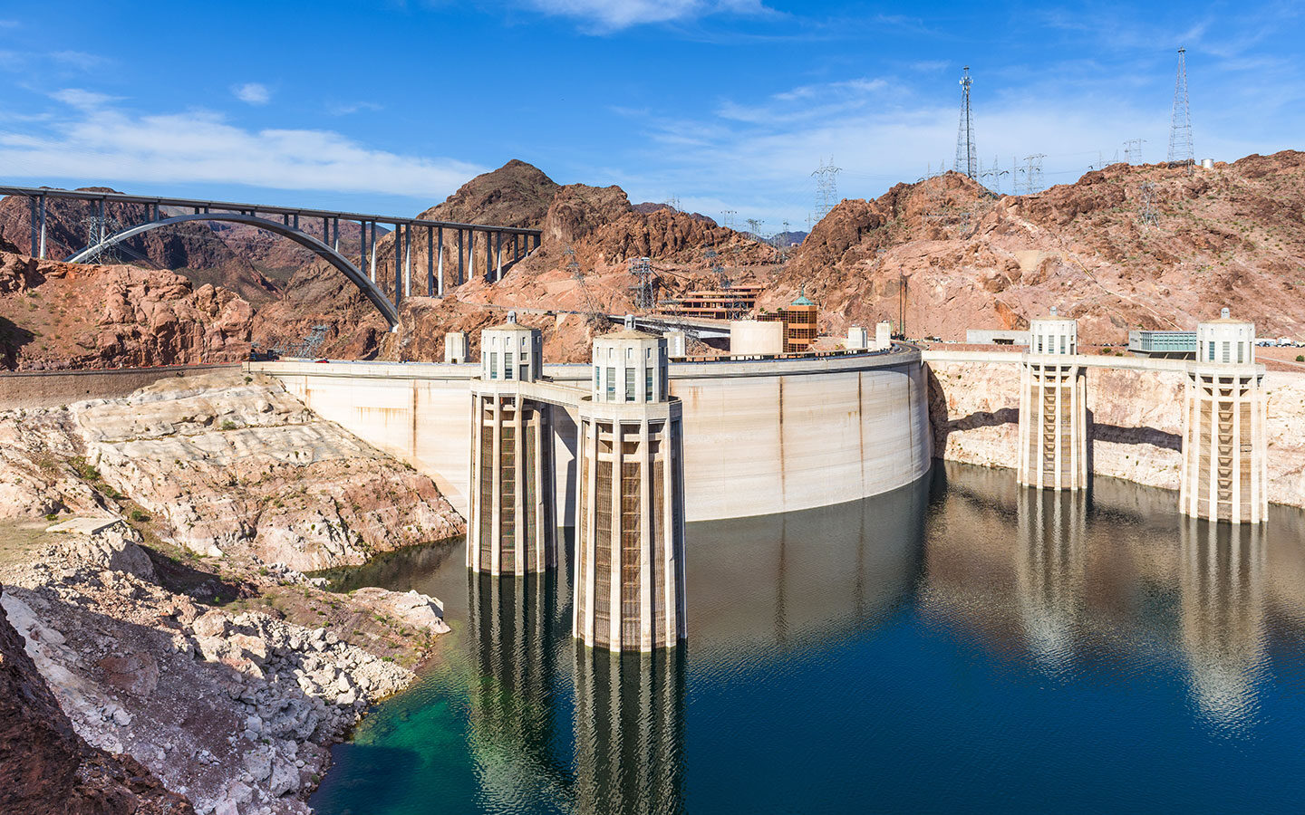
Catch sunrise over the Grand Canyon before making your way back to Las Vegas. It’s a 275-mile/4.5-hour drive, so if you have an evening flight you should have time to stop off at Lake Mead along the way to see the Hoover Dam.
The dam is a seriously impressive piece of engineering at 220 metres tall and up to 200 metres thick. There’s a visitor centre where you can find out how it was built as well as taking a look at the generators. Then from the dam it’s only 30 miles/40 mins back to the airport in Las Vegas and the end of your southwest USA road trip.
Total driving: 275 miles/426 kilometres – approx 4.5 hours
Save for later


Hi, this is a great article! Do you think we could do this trip in August or would it be too hot? Thanks
Thanks – it is very hot in some places on the route in August (e.g. Las Vegas is in the 40ºC/104ºF range) but other areas like Bryce Canyon are more reasonable (27ºC/78ºF) but may get some thunderstorms. It is also peak holiday season so book well ahead.
Wow, really amazing article. Thanks for putting this together! Would it be possible to skip Santa Fe and Albuquerque? It seems to be a very large chunk of the drive and I don’t like driving that much. I’m also not very interested in Santa Fe and would rather spread out the other visits a bit. I checked and I could go from Durango to Sedona in ~6h (340 miles). Would this make sense or is there another route you would recommend? Thanks!
Yes of course you can definitely adapt the route – Durango to Sedona would work well.
Really fabulous read, would you know of any person who can do this trip for a solo female traveller from India I don’t want to join any Tours Groups but I’d rather do it on my own and like you I would also love to volunteer for the animals
Hi, if you’re happy driving then it shouldn’t be a problem to do the trip solo.
great trip however you missed the san juan skyway loop on the million dollar hwy in Colorado. its just north of your itinerary on hwy 550 heading from Durango up through Silverton and ouray on to Ridgway then around to telluride. I’ve been almost everywhere on that loop that you showed us but you simply missed the best part of Colorado. huge mountains and old mining towns. no point in getting that close to the san juan skyway loop and not taking it. anyways just my opinion
Hi Dustin – I didn’t have time to fit it into this itinerary as there as a lot of ground to cover, but it is mentioned in my top southwest USA scenic drives post though! https://www.ontheluce.com/my-top-southwest-usa-scenic-drives/
I am in the middle of drafting our itinerary and this is so helpful, thank your very much!
When it comes to car rental, would you say that a “normal small” car can do the job or is it best to rent a SUV? Thank you
Hi Delphine, we booked a normal car but ended up getting given a small SUV but think it would’ve been fine in a normal car other than the road around Monument Valley which we didn’t want to even chance in the SUV as it was very rocky.
The itinerary looks great, have been thinking of doing a road trip to the South West. When is the best time to do this trip, and if I’m driving from Austin, Texas and is there another way to plan the route, or better to start from LV?
Spring and autumn are probably the best times as it’s not too hot but high roads can be closed due to snow in the winter. From Austin you could pick up the route in Albuquerque and then do the circuit from there rather than starting from Las Vegas.
I will have to save this article to revisit when I plan of taking another road trip to the southwest. I took a road trip past October but I started in Denver ,ended in Albuquerque going through Utah and Arizona.
Glad it was useful – the southwest is a brilliant place for a road trip!
Wow Lucy, you have done a great job showcasing the amazing American Southwest! We have been to 99% of these places and more, multiple times. Moab is one of our favorite places. I have done many reviews with pictures of most of these places. The American Southwest landscape is unlike any in the world. There are many places to observe petroglphs and the tracks of dinosaurs among this spectacular scenery also. So great job and get out and enjoy!
Thanks John, it’s a wonderful area, hope to make it back someday soon and explore some more!
Wow, this is exactly the type of trip we are looking forward to. . Both of us will be fully vaccinated by early March, and plan to travel in April, but hesitant to book anything before we know what may be closed due to the virus. Other than checking parks websites, do you have any suggestions?
Hi Roz, I would keep an eye on the NPS website as well as any travel advisories from the US government. It’s so hard to know at the moment when to start booking, April seems the earliest things are going to start going again so unfortunately I think it’s going to be quite down to the last minute as to whether travel can go ahead so I’d definitely make sure anything booked is refundable. Good luck!
Also check the Navajo Nation. They have been more locked down than the surrounding area. Monument Valley and Antelope Canyon have been completely closed.
My husband and I have been to many of the places on your itinerary but now that our son and his wife are in Prescott , we’d like to take in some of them we’ve been to and others that we missed. The one part of your two week trip I really liked was the shorter drives between each place. I hate to spend more driving time than exploring time. Thank you
You’re very welcome – enjoy, it’s a wonderful part of the world (and definitely better to spend more time exploring than driving!).
Lucy, I appreciate all the effort and dedication you’ve shown in this post. This is a perfect itinerary for our next road trip. A special compliment for the photos!
You’re very welcome – and hope you have an amazing trip!
Hello! Great info. Thanks for sharing. Could you please tell me if you think November is a good month to do that trip or too late? Thanks
Hi, you may have some snow in November, especially in the higher areas – so it’s likely the High Road to Taos will be closed and some of the routes in the other parks are closed if it snows – bonus is though that the Grand Canyon and Bryce Canyon both look stunning in the snow!